Sunday 25 October 2020

VIEIRA DO MINHO (PORTUGAL)


VIEIRA DO MINHO

 41° 38' 6.1" N; 8° 8' 30.4" W

Vieira do Minho is a Portuguese village located in the sub-region of Ave, belonging to the North region and the district of Braga.
It is the seat of the Municipality of Vieira do Minho, which has a total area of 218.05 km2, 11,955 inhabitants in 2021 and a population density of 55 inhabitants per km2, subdivided into 16 parishes:

Anissó e Soutelo; Anjos e Vilar Chão; Caniçada e Soengas; Cantelães; Eira Vedra; Guilhofrei; Louredo;
Mosteiro; Parada de Bouro; Pinheiro; Rossas; Ruivães e Campos; Salamonde; Tabuaças; Ventosa e Cova; Vieira do Minho.

The municipality is limited to the north by the municipality of Terras de Bouro, to the north and east by Montalegre, to the southeast by Cabeceiras de Basto, to the south by Fafe, to the southwest by Póvoa de Lanhoso and to the northwest by Amares.
The highest point in the municipality is located in Serra da Cabreira, more precisely in Alto do Talefe, with an altitude of 1262 meters.

The antiquity of human occupation of the lands that today make up the municipality of Vieira do Minho can be attested by the numerous archaeological testimonies that can be seen in the municipality, with particular emphasis on the Serra da Cabreira area, territory occupied since prehistory and the Salamonde and Ruivães, where the military presence of different peoples, especially the Romans, attest to the strategic value of this area in controlling the main routes of penetration into the province. The mounds, menhirs, cave engravings, medieval pits, Neolithic necropolises, Roman settlements, castros, as well as various clay, iron and other metal utensils, are examples of the region's archaeological lode, which is quite underexplored.
From Roman times, there are still traces of some sections of Via XVII of the Antonino route that connected Braga, Chaves to Astorga, and traces of ancient settlements from that era, an example of which is the settlement of São Cristovão - Ruivães


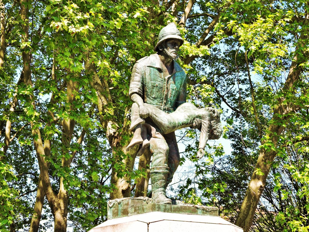
Due to its extreme importance in military strategy, the region suffered the effects of the penetration of the different peoples that invaded the peninsula, from the Swabians to the Romans, and much more recently from the Napoleonic armies. In fact, in the spring of 1809, Marshal Soult's troops crossed the county twice: the first on March 15, in an impetuous advance on the way to Braga. The second, on the 17th of May, in a hasty retreat across the Misarela bridge, on the exact day that Wellesley's Anglo-Portuguese forces arrived at the top of Salamonde, with the frustrated aim of cutting them off.

This penchant for involvement in war also determined that Vieira became involved in the liberal wars, Ruivães witnessing hard fights between liberals and absolutists, and shortly afterwards, in April 1846, Vieira became enthusiastic about the popular movement of “Maria da Fonte”. where he had his origin and where his mentor lived: Father Casimiro José Vieira.
These notes are the testimony of the history of Vieira do Minho, made more of its strategic value than of the memory of men embodied in monuments and cities.


FÃO + OFIR (ESPOSENDE)


FÃO

 41° 31' N; 8° 47' W

Fão is a Portuguese village in the municipality of Esposende, with an area of 5.76 km² and 3,103 inhabitants (2011). Density: 538.7 inhabitants/km².
Fão is known for its beach, Praia de Ofir.

Fão has the largest medieval necropolis in the Iberian Peninsula (Medieval Cemetery of Barreiras), demonstrating the impact of the Black Death. Still, during medieval times, Fão was a relevant salt production centre. The historic center of Fão dates back to the 16th and 17th centuries.
Its natural wealth is exuberant, thanks to the partnership of the sea with the estuary of the river Cávado, creating dunes and cliffs, pine forests, heaths and marshes, which are inhabited by countless animal and plant species. Much of the coastline of Fão is protected within the area of the Natural Park of the North Coast.
The main economic activities are agriculture, fishing, tourism and services.


OFIR BEACH
Ofir is a beach located in the parish of Fão, municipality of Esposende, District of Braga.
The name Ophir appears in the Old Testament several times, including to designate a land far from Israel where gold was collected. Ophir gold is often referred to as a separate gold, which is perhaps due to the joint expedition of King Solomon and King Hiram (Tyre, Phoenicia) which left the Red Sea and brought back 14 or 15 tons of gold from Ophir.
Thus, perhaps the Portuguese beach is related to a new Ofir discovered by the Phoenicians. A famous local legend, the "legend of the horses of Fão", even states that "the biblical Ofir" was in the place of the current Ofir.


OFIR

N 41º 31' 12,24; W 8º 47' 18,38


APÚLIA (PORTUGAL)


APÚLIA
41° 29' N;  8° 46' W

Apúlia is a Portuguese village in the municipality of Esposende, with an area of 10.53 km² and 4,198 inhabitants (2011) and a density of 398.7 inhabitants/km².
It was the seat of a parish that was extinguished in 2013, as part of a national administrative reform, to, together with Fão, form a new parish called União das Freguesias de Apúlia and Fão, of which it is the seat.
One of the main ex-libris of Apúlia is its extensive beach, Praia da Apúlia, with areas of extensive sand and rocky areas.

Apulia beach
Praia da Apúlia is an Oceanic Beach located on the coast of Portugal - Iberian Peninsula - in the Union of Parishes of Apúlia and Fão, municipality of Esposende, bathed by the Atlantic Ocean. Integrates the sea front of the village of Apúlia. Its beach is wide, although not very extensive.
To the south it is bounded by a pier and the mouth of the Ribeira da Fonte da Senhora. In the central area of the bathing area there is a rocky cluster that becomes visible during low tide.
It is a beach much appreciated by lovers of water sports, due to the windy weather conditions most of the time.
During the bathing season, sporting events are often held on Apúlia beach, namely football tournaments.


VILA NOVA DE FAMALICÃO (PORTUGAL)


VILA NOVA DE FAMALICÃO

41° 25' N; 8° 31' W

Vila Nova de Famalicão or Famalicão is a Portuguese city located in the sub-region of Ave, belonging to the North region and the district of Braga.
It is the seat of the Municipality of Vila Nova de Famalicão, which has a total area of 201.59 km2, 133,574 inhabitants in 2021 and a population density of 663 inhabitants per km2, subdivided into 34 parishes:

Antas e Abade de Vermoim;
Arnoso (Santa Maria e Santa Eulália) e Sezures;
Avidos e Lagoa;
Bairro;
Brufe;
Carreira e Bente;
Castelões;
Cruz;
Delães;
Esmeriz e Cabeçudos;
Fradelos;
Gavião;
Gondifelos, Cavalões e Outiz;
Joane;
Landim;
Lemenhe, Mouquim e Jesufrei;
Louro;
Lousado;
Mogege;
Nine;
Oliveira (Santa Maria);
Oliveira (São Mateus);
Pousada de Saramagos;
Pedome;
Requião;
Riba de Ave;
Ribeirão;
Ruivães e Novais;
Seide;
Vale (São Cosme), Telhado e Portela;
Vale (São Martinho);
Vermoim;
Vila Nova de Famalicão e Calendário;
Vilarinho das Cambas.

The municipality is limited to the north by the municipality of Braga, to the east by Guimarães, to the south by Santo Tirso and Trofa, to the west by Vila do Conde and Póvoa de Varzim and to the northwest by Barcelos.
The highest point in the municipality is at Penedo das Letras, at an altitude of 468 meters.

Geography
Vila Nova de Famalicão is located in the province of Minho, in the district and archdiocese of Braga.

The city is located on an important road junction that connects it to Porto, Braga, Barcelos, Guimarães, Póvoa de Varzim and Santo Tirso. Both on a road and rail level, Vila Nova de Famalicão is a town with an excellent geographical location, which makes it a mandatory crossing point.

The city is 30 minutes from Francisco Sá Carneiro International Airport and the Port of Mar de Leixões, crossed by motorways, national roads and railways that link the main urban centers in the north of the country and Europe.
The region of Vila Nova de Famalicão has a Csb Mediterranean climate.


Devesa Park
Parque da Devesa was inaugurated on the 28th of September 2012 by the Mayor Armindo Costa, Vice-President Paulo Cunha and the rest of the Council, by the President of the Municipal Assembly Nuno Melo and by the Archbishop Primate of Braga D. Jorge Ortiga.
It is a recent work, but the first initiatives for its construction date back to 1988 with the Detailed Plan for the Area Adjacent to the Building of Lameiras. Until 2011, several plans/projects were approved, and in that same year, construction began.
It occupies an area of approximately 27 hectares and extends from Avenida General Humberto Delgado and Avenida do Brasil to the junction of the A3 and Santiago de Antas. It has an extensive network of pedestrian paths, on which families can enjoy walks or cycling; as well as large expanses of green areas that allow outdoor activities to be carried out, such as group classes in the gym, dance, karate, among others.
The rural constructions previously existing on the site were rehabilitated and transformed into cultural equipment and services such as the Casa do Território, Archeology Center, Cafeteria, Support Services and Educational Services. The Environmental Education unit implemented in the Educational Services will recover the Pelhe River, which is one of the most polluted in the municipality. It is possible to follow the evolution of the river, as well as other news on the park's facebook page or on the official page.

History
The historical remains on the origin of the settlement of this land, takes us to the Iron Age, more properly to archaeological remains of hillforts throughout the county.

Castro do Monte das Ermidas, perhaps founded in the 4th century BC, Castro de São Miguel-o-Anjo or Castro de Eiras, are some of the archaeological remains of remote settlements that the county has. The Pedra Formosa do Castro de Eiras, which belonged to a bathing complex, was discovered in 1880 and, according to archaeologists, it dates from the first millennium before Christ.

Geography
Vila Nova de Famalicão is located in the province of Minho, in the district and archdiocese of Braga, is the seat of the municipality and county, and is on flat ground at an altitude of 88 meters.

Famalicão is a tourist destination in Northern Portugal, enjoying a strategic location with fast links to the cities of Braga, Porto, Guimarães, Viana do Castelo, Barcelos, Santo Tirso and Vigo.

The city is 30 minutes from the international airport Francisco Sá Carneiro and the Leixões maritime port, crossed by highways, national roads and railways that unite the main urban centres of the North of Portugal and Europe.

The Vila Nova de Famalicão region has a Csb Mediterranean climate.

Economy
The economy of the municipality is mainly based on textile, automotive, metal-mechanic and agrofood industries, hosting the headquarters or branches of some large companies, such as Continental Mabor, Leica, Riopele, Vieira de Castro, and Primor.